§ Work · vii. · Alynix
Bridge inspection at the speed of a drone.
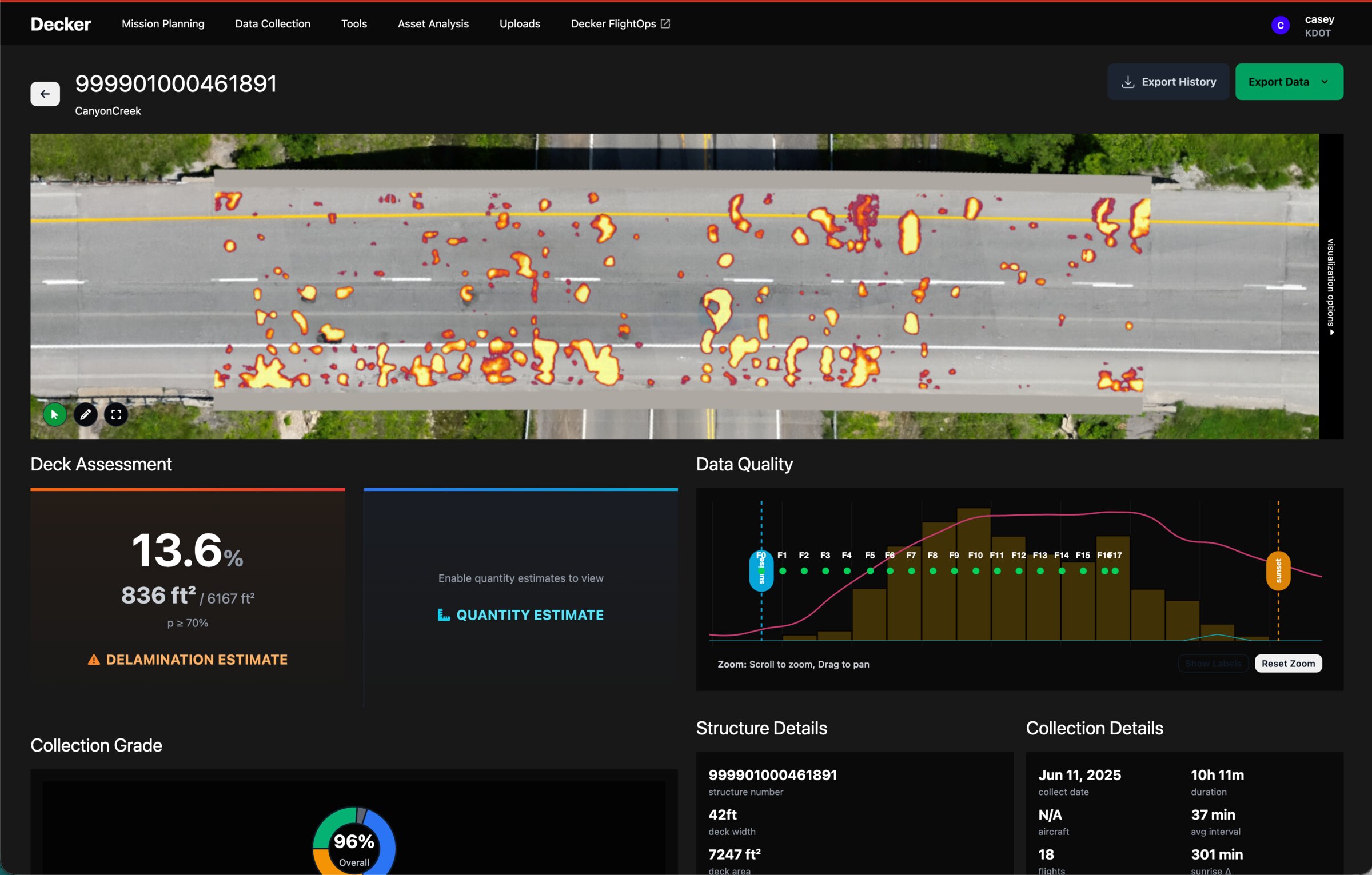
Decker replaces a slow, lane-closure-heavy hammer-sounding inspection with a thermal flight, an automated processing pipeline, and a defect map a structural engineer can sign.
- Client
- Alynix
- Year
- Multi-year, ongoing
- Role
- Architect → CTO
- Outcome
- In production with state DOTs
The premise
The way the United States inspects its bridges in 2026 looks a lot like the way it inspected them in 1976. An engineer, a hammer, a chain, lane closures, traffic delays, and a clipboard. The data product at the end of all of it — a deck map showing where the concrete is delaminating — is essentially the same data product a calibrated thermal camera in the air can produce, faster, safer, and at a cost that finally makes routine inspection economic at scale.
Alynix's bet was that the bottleneck wasn't the imaging. It was the platform around it — capture planning, processing, defect detection, and reporting that fit into how state DOTs already work. That's what we built.
01 · Plan
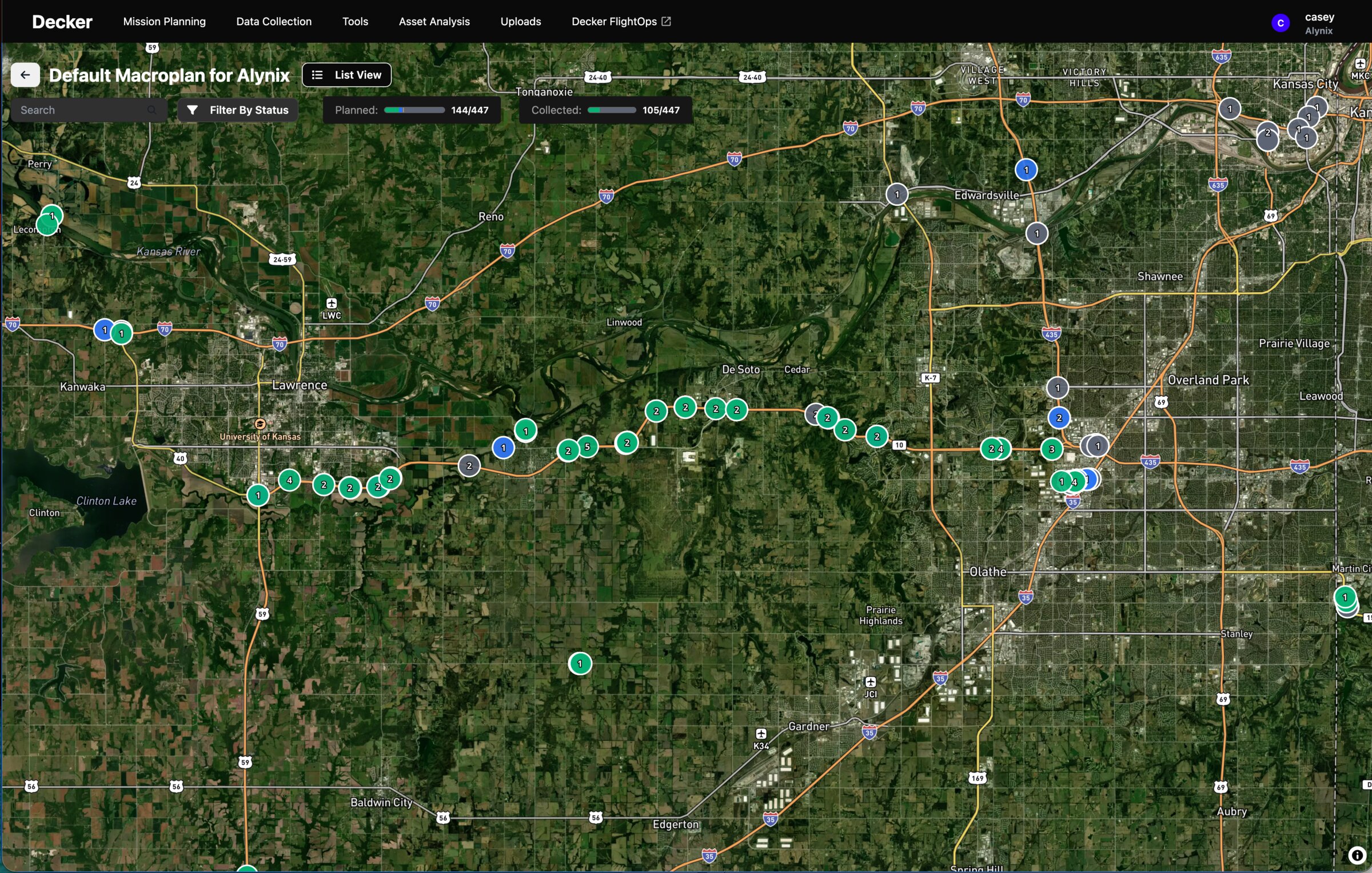
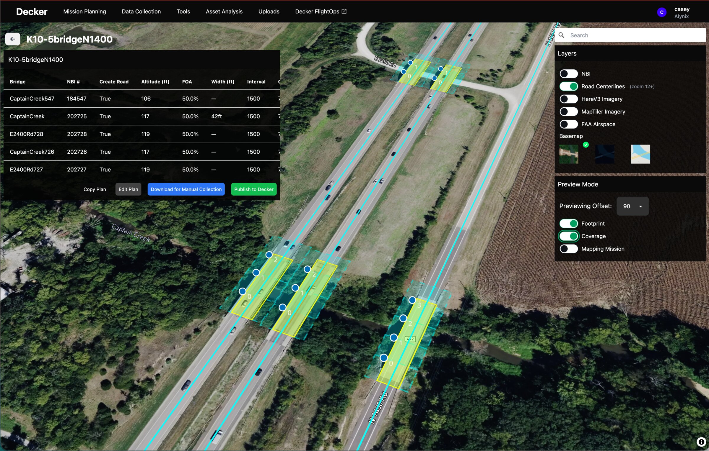
Flight planning
Per-bridge mission planning that accounts for span geometry, sun angle, thermal contrast windows, and FAA constraints — so a pilot shows up with a flight that's actually going to produce usable data.
02 · Capture
Thermal flight
A thermal-equipped drone flies the deck under conditions where subsurface delamination shows itself thermally. No lane closures, no jackhammers, no traffic control plan.
03 · Process
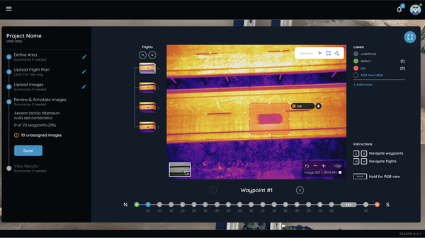
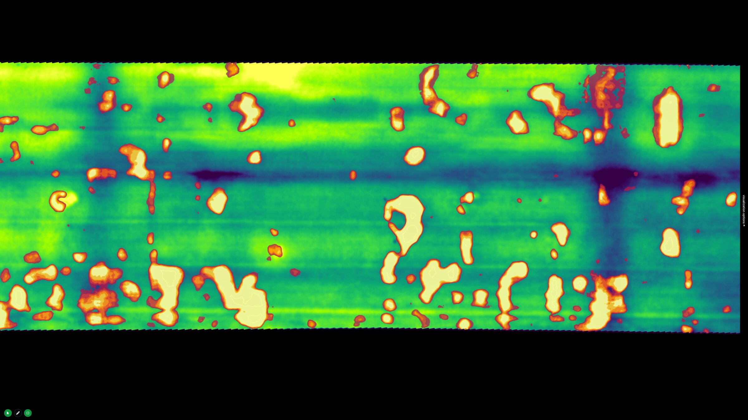
Register & detect
Frames are stitched, geo-registered, and orthorectified into a single deck mosaic; a detection model identifies thermal anomalies consistent with delamination and bounds them as defects.
04 · Report
DOT-ready deliverable
A structured deck-condition report that fits a state DOT's existing inspection workflow — not a dump of raw imagery, a thing an engineer can review and sign.
My role
I started on Decker as the architect of the platform through Lofty Labs — mapping out the system, the data flow, the team, and the build. Over the course of the engagement, my role with Alynix expanded: I transitioned into a CTO seat to help drive go-to-market alongside the founders, taking on commercial conversations, customer engagements, and the technical credibility that selling into state DOTs requires.
The engagement remains ongoing. The core platform is a Django + PostGIS application with a Vue.js operator UI; the heavy work happens in a Python image-processing stack — OpenCV, GDAL, NumPy, scikit-image — with PyTorch-based detection models on top, all wrapped in a workflow that a non-developer field engineer can drive.
What changed
Decker is in production use with state DOT clients today. The category — remote, sensor-driven infrastructure inspection — is moving from interesting research to procured service, and Alynix is one of the small number of companies actually delivering it on real bridges.
The path from raw sensor capture to a deliverable an industry buyer will sign for is its own discipline. If that's the path you're on, get in touch.
Start a conversation →